'; } else { caption += $(this).find('figcaption').html() + getDetailsURL($(this).parent()) + getDownloadURL($(this).parent()) + showFBShare(); } } else { if (isMobile()) { caption += '
' + '
' + '
' + '
' + '
' + $(this).find('figcaption p').html() + '
' + getDetailsURL($(this).parent()) + getDownloadURL($(this).parent()) + showFBShare() + '
' + '
' + '
SHOW PHOTO DETAILS
'; } else { caption += '
' + '
' + $(this).find('figcaption p').html() + '
' + getDetailsURL($(this).parent()) + getDownloadURL($(this).parent()) + showFBShare(); } } return caption; }, afterLoad: function (instance, current) { //initial desktop view $(".fancybox-caption__body").addClass("a2a_kit").addClass("a2a_default_style"); if (isMobile()) $(".fancybox-caption__body").addClass("mobile"); }, afterShow: function (instance, current) { var $currentSlide = $(".fancybox-slide.fancybox-slide--current").parent().parent(); if (isMobile()) $currentSlide.find(".fancy-detail-link").on("touchstart", function () { captionToggle(); }); }, afterClose: function () { } })); let debounceTimer; $(window).on("resize", function (event) { if (isMobile()) return; if ($(".af3-caption-body").length > 0 && $(".af3-caption-body").css("height") != undefined) { event.stopImmediatePropagation(); $(".fancybox-caption__body").removeClass("half"); isDesktopInit = false; captionToggle(); debounceTimer = setTimeout(function () { clearTimeout(debounceTimer); debounceTimer = null; recalculateImageSize(); }, 1000); } }); function recalculateImageSize() { // Fancy box miscalculates because of race conditions with new layout var origImgWth = $(".fancybox-image").prop("naturalWidth"); var origImgHgt = $(".fancybox-image").prop("naturalHeight"); var winWth = $(window).innerWidth(); var winHgt = $(window).innerHeight() var ratio = Math.min(winWth / origImgWth, winHgt / origImgHgt); var newImgWth = (origImgWth * ratio); var newImgHgt = (origImgHgt * ratio); var dstTop = Math.floor((winHgt - newImgHgt)) / 2; var dstLeft = Math.floor((winWth - newImgWth)) / 2; $(".fancybox-content").removeAttr("style"); $(".fancybox-content").css("width", newImgWth + "px"); $(".fancybox-content").css("height", newImgHgt + "px"); $(".fancybox-content").css("transform", "translate(" + dstLeft + "px, " + dstTop + "px)"); } function captionToggle() { if ($(".fancybox-caption__body").hasClass("af3-caption-body")) { $(".af3-caption-body").stop(true, false).animate({ height: "0vh" }, 800, function () { // Animation complete. closeDetails(); }); $(".fancy-photo-detail-link").html($(".fancy-photo-detail-link").html().replace("CLOSE", "SHOW")); } else { $(".fancybox-caption__body").addClass("af3-caption-body"); $(".af3-caption-body").addClass(detailSize); $(".af3-caption-body").animate({ height: displayhgt }, 800); $(".fancybox-caption").addClass("af3-caption-bg"); $(".base-caption-info").addClass("full-height"); $(".fancy-photo-detail-link").addClass("photo-detail-gradient"); $(".fancybox-button").css("display", "none"); $(".fancy-photo-detail-link").html($(".fancy-photo-detail-link").html().replace("SHOW", "CLOSE")); $(".fancybox-caption__body").prepend(prependClosing()); $(".closing-box, .closingx").on("touchstart", function () { captionToggle(); }); } } function getDetailsURL(fbObj) { return 'DETAILS'; } function getDownloadURL(fbObj) { return 'DOWNLOAD'; } function showFBShare() { return ''; } function closeDetails() { $(".af3-caption-body").removeClass(detailSize); $(".fancybox-caption__body").removeClass("af3-caption-body"); $(".fancybox-caption").removeClass("af3-caption-bg"); $(".base-caption-info").removeClass("full-height"); $(".fancy-photo-detail-link").removeClass("photo-detail-gradient"); $(".fancybox-button").css("display", "block"); if (detailSize === "half") { detailSize = "full"; displayhgt = "90vh"; $(".fancybox-caption").removeClass("desktop-init"); } } function prependClosing() { return '
' } });
- By Space Operations Command
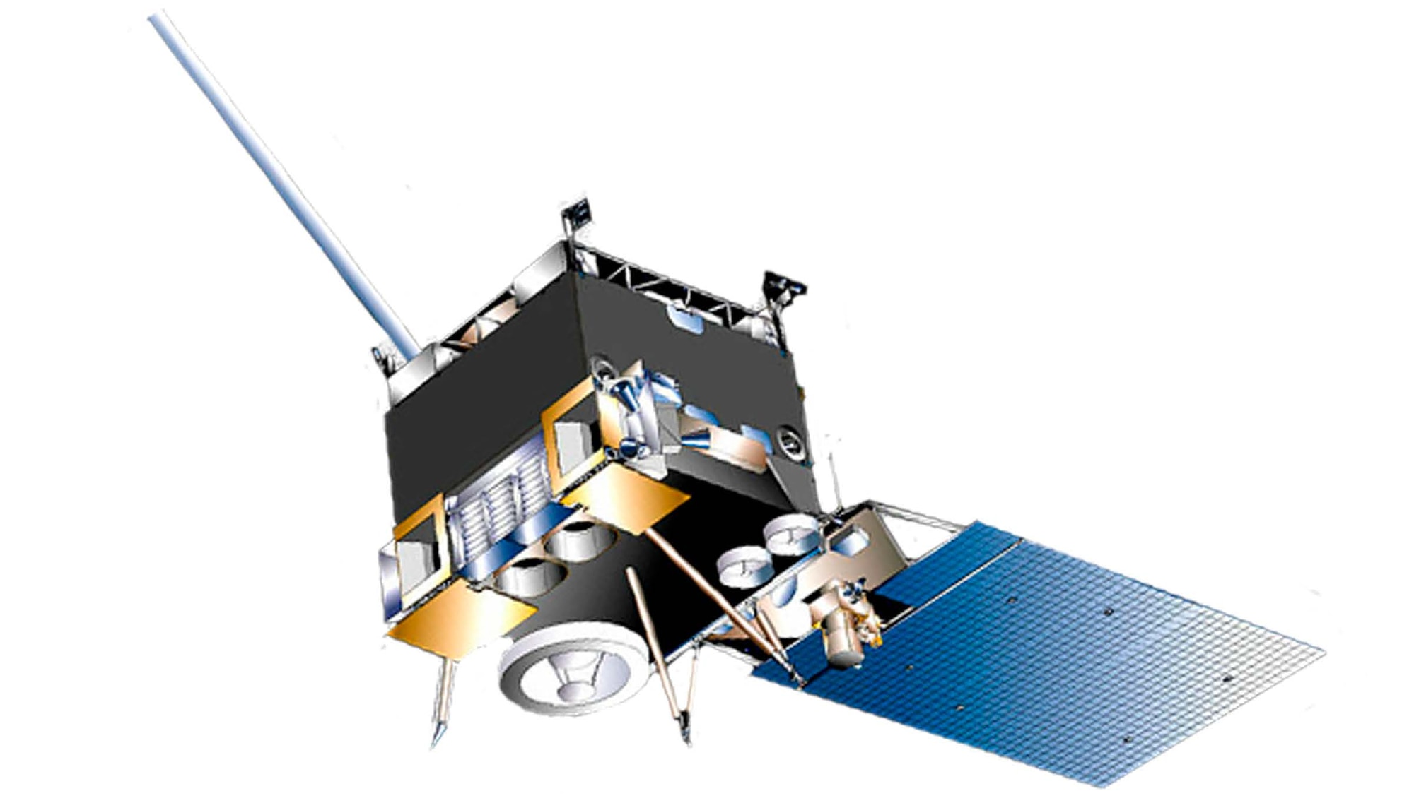
The EO/IR Weather System – Geostationary (EWS-G1), formerly Geostationary Operational Environmental Satellite (GOES)-13, satellite collects cloud imagery to enable fielded forces to perform environmental reconnaissance and cloud characterization over the Indian Ocean (IO) region. This information is critical to the preparation of operational and tactical level plans and courses of action in the IO Area of Responsibility (AOR). Data are instrumental for assessing and predicting feasibility of certain types of air and surface missions, anticipating effectiveness of platforms/weapons systems and munitions, determining optimal times and locations for conducting operations, and evaluating logistical, survivability, protection, and quality-of-life requirements.
SPACECRAFT BUS SIZE – LENGTH = 4.2 M, WIDTH = 1.88 M
SPACECRAFT ON-ORBIT CONFIGURATION – LENGTH = 8.4 M, (SOLAR ARRAY TO SPACECRAFT BODY)
HEIGHT = 9.1 M (IMAGER PORT TO MAGNETOMETER BOOM)
DEPTH = 2.9 M
SPACECRAFT LAUNCH MASS – 3,209.5 KG, DRY MASS = 1,543 KG
FEATURES
The EWS-G1 satellite is in ageostationary orbit at about22K miles. The main weathersensor on EWS-G1 is anoptical system, which providescontinuous visual and infraredimagery of cloud cover overthe IO area. EWS-G1 providesessential data over datasparseand data-denied areas.Military weather forecasterscan detect developing patternsof weather and track existingweather phenomena overremote areas, including thepresence of fog, severethunderstorms, dust andsandstorms, and tropicalcyclones in the IO region.The EWS-G1 satellite systemcollects and disseminatesGOES Variable (GVAR) missiondata to the Department ofDefense (DoD) weathercenters and theater tacticalusers. Conversion of GVARmission data to processedmission data is accomplishedby users using existingmission processing capabilityemployed for the GOES-NSeries (GOES NOP) satellites.The DoD weather centersprovides processed missiondata, post-processed mission data, and internally generated weatherproducts to downstream operational customers.The primary control for the EWS-G1 satellite is through National Oceanicand Atmospheric Administration’s (NOAA)’s Wallops Command and DataAcquisition Station (WCDAS) for Telemetry, Tracking, and Command (TT&C)services with backup TT&C provided by the NOAA Satellite OperationsFacility (NSOF) located at Suitland, MD. EWS-G1 GVAR mission data arereceived and processed at the Remote Ground Station (RGS) at Dongara,Western Australia, and relayed to the WCDAS, NSOF, and DoD WeatherCenters for data processing and product development.
BACKGROUND
EWS-G1 is a weather satellite of the U.S. Space Force (USSF) and was part ofNOAA’s GOES NOP systems. On 14 April 2010, GOES-13 became the operationalweather satellite for OES-East. It was replaced by GOES-16 in 2017 and wasplaced in on-orbit storage.In 2017, a gap in SBEM coverage over the IO region occurred due to theimpending loss of UMETSAT Meteosat 7, and although the capabilitywas partially replaced by Meteosat 8, a coverage gap continues in theeastern portion of that region. Because of this impending gap, the USAFapproached NOAA concerning the possibility of leveraging their residualGOES-NOP capabilities until a long-term solution can be established. InNovember 2017, a Memorandum of Agreement (MOA) was signed coveringcooperation on the GOES IO Relocation Plan which transferred the GOES-13 spacecraft to the USSF for ownership, operations and sustainment tocover the expected gap until a more long-term solution can be acquired.Satellite Control Authority (SCA) resides with Space Delta 2 (DEL 2) and isdelegated to the 19th Space Defense Squadron, Operating Location-Alpha(OL-A), located at the NSOF, for oversight of the EWS-G1 satellite.EWS-G sustainment is provided by the USSF Space Systems Command(SSC) at Los Angeles SFB, CA.
General Characteristics
Launch date: May 24, 2006, 6:11 PM EDT
Orbit height: 22,236 mi
Speed on orbit: 1.908 miles/s
Power: 2,300 watts
Manufacturer: Boeing
Rocket: Delta IV
Launch site: Space Launch Complex
(Current as of Feb 2023)
